
Loading…
Loading…
Get to know the canton
A land of rivers, rainforest and plains in northern Costa Rica: the largest canton in Heredia, a historic route to the Caribbean and a stage of the 1856 National Campaign.
Pre-Columbian era
The Votos, an Indigenous people, live on the plains of Sarapiquí.
1640
A colonial document calls the river Siripiquí, the name that would later be given to the canton.
1727–1729
According to archaeologist Mauren Sánchez, a Spanish fort stood in La Trinidad: the region was widely explored between the 16th and 18th centuries.
1819
Pío Murillo, from Barva, links the Central Valley with Sarapiquí. People and goods start traveling along the river between Costa Rica and Europe.
1856–1857
During the National Campaign, the battles of Sardinal and La Trinidad, led by General Máximo Blanco, defeat William Walker's troops.
1862
The village of Sarapiquí becomes part of the Santa Bárbara district, in the canton of Heredia.
1915
Law No. 20 makes it the sixth district of the canton of Heredia.
1970
On November 18, Law No. 4671 creates canton 10 of Heredia, during José Figueres Ferrer's second term. Puerto Viejo becomes a city and the canton seat.
2007
The park in La Virgen and the boulevard in Puerto Viejo are named after Silvestre Durán Calvo and Salvador Durán Ocampo, locals who fought in 1856.
Origin of the name
The canton is named after the river that rises and flows through the region. Historian Carlos Gagini cites a 1640 document that calls it Siripiquí, as the Miskito Sambu people named it.
National Campaign · 1856–1857
About 700 Costa Rican soldiers, on rafts and canoes, in the rain and without supplies, cut off the filibusters' supply line along the San Juan River. Today there are historic landmarks in Sardinal, Muelle and La Trinidad.

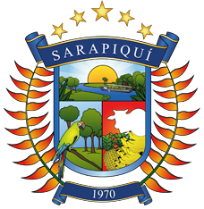
The five stars stand for the five districts.
42.2% of the population22,598 people · 39.9 per km²566.44 km²
38.7% of the population20,749 people · 48.6 per km²426.73 km²
16.3% of the population8,715 people · 17.0 per km²513.65 km²
1.5% of the population804 people · 2.2 per km²367.51 km²
1.4% of the population730 people · 2.7 per km²266.21 km²
Area and population published by the Municipality (IFAM, 2002).
Social Development Index: 21.2 (rank 68 of 81 cantons).
Post it on the map so all of Sarapiquí can see it.